Using ICT to Improve Traffic Management
Overview
Traffic congestion is a serious and growing issue for Victorian businesses and individuals. As the state’s economy and population grows, traffic congestion is expected to increase, particularly in Melbourne.
This audit assessed VicRoads’ use of ICT traffic management systems to improve traffic flow on Melbourne’s arterial roads and freeways. The audit found that there is no clear strategy or coordinated plan to leverage ICT systems to complement transport and land use initiatives.
The audit also found that although VicRoads has put ICT traffic management systems to good use on a day-to-day basis, it has not strategically deployed these systems to more effectively manage traffic flow.
Traffic signal reviews are one example of a cost-effective tool available to VicRoads to optimise the efficiency of deployed intelligent transport systems, but they are declining in number and frequency, even though international research shows that they can provide substantial positive outcomes when compared to costs.
Finally, public transport tracking systems are obsolete and lack effective interfacing with road traffic signals, which means that tram and bus priority is not always provided when required. This runs counter to the SmartRoads policy intention to provide prioritisation for higher capacity vehicles on the metropolitan road network.
Using ICT to Improve Traffic Management: Message
Ordered to be printed
VICTORIAN GOVERNMENT PRINTER June 2014
PP No 332, Session 2010–14
President
Legislative Council
Parliament House
Melbourne
Speaker
Legislative Assembly
Parliament House
Melbourne
Dear Presiding Officers
Under the provisions of section 16AB of the Audit Act 1994, I transmit my report on the audit Using ICT to Improve Traffic Management.
The audit assessed the effectiveness of VicRoads’ management of the ICT systems it uses to improve traffic flow outcomes on Melbourne’s arterial road system and freeways.
The audit focused on the Department of Transport, Planning and Local Infrastructure, Public Transport Victoria and VicRoads. It found that there is no strategy or coordinated plan for using ICT traffic management systems to complement broader integrated transport and land-use initiatives. The audit also found that public transport tracking systems are obsolete and lack an effective interface with road traffic signals, which means that tram and bus priority is not always provided when required.
Overall, the implication from this audit is that broader aspirations for more sustainable and amenable road use and urban planning are not being directly supported and operationalised by technology solutions.
I have made eight recommendations aimed at improving the use of ICT traffic systems across the state, all of which have been accepted by the relevant agencies.
Yours faithfully

John Doyle
Auditor-General
11 June 2014
Auditor-General's comments
 John Doyle Auditor-General |
Audit team Paul O’Connor—Sector Director Elsie Alcordo—Team Leader Kate Day—Senior Analyst Annie Skelton—Analyst Reece Jones—Analyst Steven Vlahos—Engagement Quality Control Reviewer |
Despite the government's significant investment on Victoria's extensive road network, mobility and productivity is being increasingly degraded by growing traffic congestion.
There is no single solution to the congestion problem. A comprehensive range of interventions need to be considered such as capacity expansion, demand management, ICT solutions, and economic or pricing measures.
However, in the short term, it is important that we optimise the available capacity of existing infrastructure through effective traffic management.
This audit focused on one aspect of traffic management—the use of intelligent transport systems.
My audit found that although ICT traffic management systems are critical in managing traffic flow, their effectiveness is limited when road capacity is increasingly saturated, which is the case for many arterial roads across metropolitan Melbourne, particularly during the morning and afternoon peak periods.
The audit also found that the deployment of ICT traffic management systems has not been strategically planned to complement broader statewide integrated transport and land-use initiatives.
Trams and buses are not currently able to provide accurate and reliable reference data to VicRoads traffic signals systems, and thus more efficient public transport traffic signal prioritisation is not available to these high-productivity vehicles.
The solutions to traffic congestion require a multi-faceted approach, and the Department of Transport, Planning and Local Infrastructure (DTPLI), which has portfolio responsibility for integrated transport policy, should be more proactive in setting the strategic agenda for traffic congestion.
I note that VicRoads, DTPLI and Public Transport Victoria have accepted all my recommendations and have indicated specific courses of action in their responses. I will be keenly following the development of the Road Use Strategy and Network Development Plan—On-Road Public Transport, which DTPLI claims will address the need for a coordinated approach to traffic management.
The importance of transport to the Victorian economy, and communities in general, is a persuasive reason to take action now before the congestion problem becomes even more difficult to manage.
I would like to thank the DTPLI, PTV and VicRoads for their assistance and cooperation during the course of this audit.

John Doyle
Auditor-General
June 2014
Audit Summary

As Victoria's economy and population continue to grow, traffic congestion is expected to get worse, particularly in Melbourne and other urbanised areas. Although Victorian roads are not as severely congested as other international localities, traffic congestion is widely perceived as a serious and growing concern for Victorian businesses and individuals.
In 2006, the Victorian Competition and Efficiency Commission estimated that the economic cost of Melbourne's congestion was in the range of $1.3 billion to $2.6 billion per year, and that this range was likely to double by 2020.
Intelligent transport systems (ITS) use ICT to manage road networks and coordinate traffic to reduce congestion, as well as improve safety and travel times.
VicRoads developed the SmartRoads framework in 2010 to manage competing demands for scarce road space. SmartRoads prioritises certain modes of transport on particular routes according to the surrounding land use and time of day.
ICT can play an important part in achieving SmartRoads objectives by:
- allowing traffic signal priority for road-based public transport
- reducing delays for pedestrian traffic
- providing variable speed limits
- improving signal coordination and active management of freeways
- providing real-time traffic information to commuters.
This audit examined whether:
- current ICT traffic management systems are operating efficiently, and reviews and optimisation of these systems are effective in improving traffic flow
- ICT traffic management initiatives and plans are effective and clearly link with broader strategic objectives to improve traffic flow.
Conclusions
Although VicRoads has been efficient in its day-to-day operational deployment of ICT across the road network, this has not translated into fully effective use of ICT to manage traffic across the metropolitan road network.
Notably, there is no clear strategy or plan to leverage the internationally recognised role and capability of ICT to improve journey outcomes in the heavily congested road environment of metropolitan Melbourne.
These highly congested road spaces are also reducing the opportunity for technology to actively manage traffic, which means that other regulatory or engineering solutions, in conjunction with technology, will need to be actively developed and considered.
The Department of Transport, Planning and Local Infrastructure (DTPLI), Public Transport Victoria (PTV) and VicRoads have no strategy or coordinated plan to use ICT traffic management systems to complement broader integrated transport and land‑use initiatives. This means that broader aspirations for more sustainable and amenable road use and urban planning are not being directly supported and operationalised by technology solutions.

Photograph courtesy of TK Kurikawa/Shutterstock.com.
Despite previously agreeing to develop a congestion management plan, as recommended by our 2013 Managing Traffic Congestion audit, DTPLI documents show that the department now does not support this approach and will instead address congestion through the broader objectives of transport and land-use strategies.
This audit found that VicRoads has cost-effective tools available to optimise the efficiency of ITS deployed across the road network. Operational route reviews are one example, but they are declining in number and frequency, even though international research shows that they can provide substantial positive outcomes when compared to costs.
Finally, obsolete or absent public transport vehicle tracking systems and a lack of effective interface with the road traffic signals system mean that tram and bus priority is reactive and is not always provided when required.
This contradicts the SmartRoads policy approach to prioritise higher capacity vehicles and higher productivity journeys on the road network. It also runs counter to internationally recognised better practice for road-based public transport priority.
Findings
DTPLI, PTV and VicRoads have not strategically planned the deployment of ICT traffic management to complement broader statewide integrated transport and land-use initiatives.
VicRoads has not strategically or appropriately planned its use of ICT traffic management systems, and is unable to provide assurance that it is maximising the effective use of its systems, or whether it has the ITS tools and assets it needs to better manage traffic in metropolitan Melbourne.
Trams and buses are not currently able to provide accurate and reliable reference data to VicRoads traffic signals systems. This limits VicRoads' ability to provide efficient public transport traffic signal prioritisation.
In terms of system performance, the ICT traffic management systems deployed by VicRoads are able to detect when traffic flow is being impeded, and can provide a timely response to smooth traffic flow.
However, the effectiveness of these traffic systems is limited when road capacity is increasingly saturated, as is the case for many arterial roads across metropolitan Melbourne, particularly during morning and afternoon peak periods.
VicRoads has not complied with its own internal guideline to review traffic signals once every five years in order to assess their effectiveness in handling traffic conditions.
At the rate it currently conducts these reviews, VicRoads will only be likely to review traffic signals once every 20 years. This will not only negate the opportunity to improve currently deployed ITS, but also pass on a further backlog of reviews to future years.
Recommendations
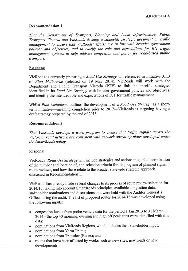
- That the Department of Transport, Planning and Local Infrastructure, Public Transport Victoria and VicRoads develop a statewide strategic document on traffic management to ensure that VicRoads' efforts are in line with broader government policies and objectives, and to clarify the role and expectations for ICT traffic management systems to help address congestion and priority for road-based public transport.
That VicRoads:
- develops a work program to ensure that traffic signals across the Victorian road network are consistent with network operating plans developed under the SmartRoads policy
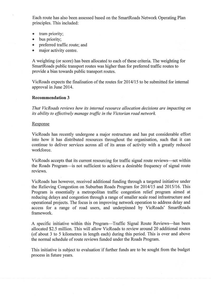
- reviews how its internal resource allocation decisions are impacting on its ability to effectively manage traffic in the Victorian road network.
That Public Transport Victoria:
- upgrades and improves the quality and reliability of bus and tram ICT systems communications and interface with the Sydney Coordinated Adaptive Traffic System to enable more effective public transport prioritisation
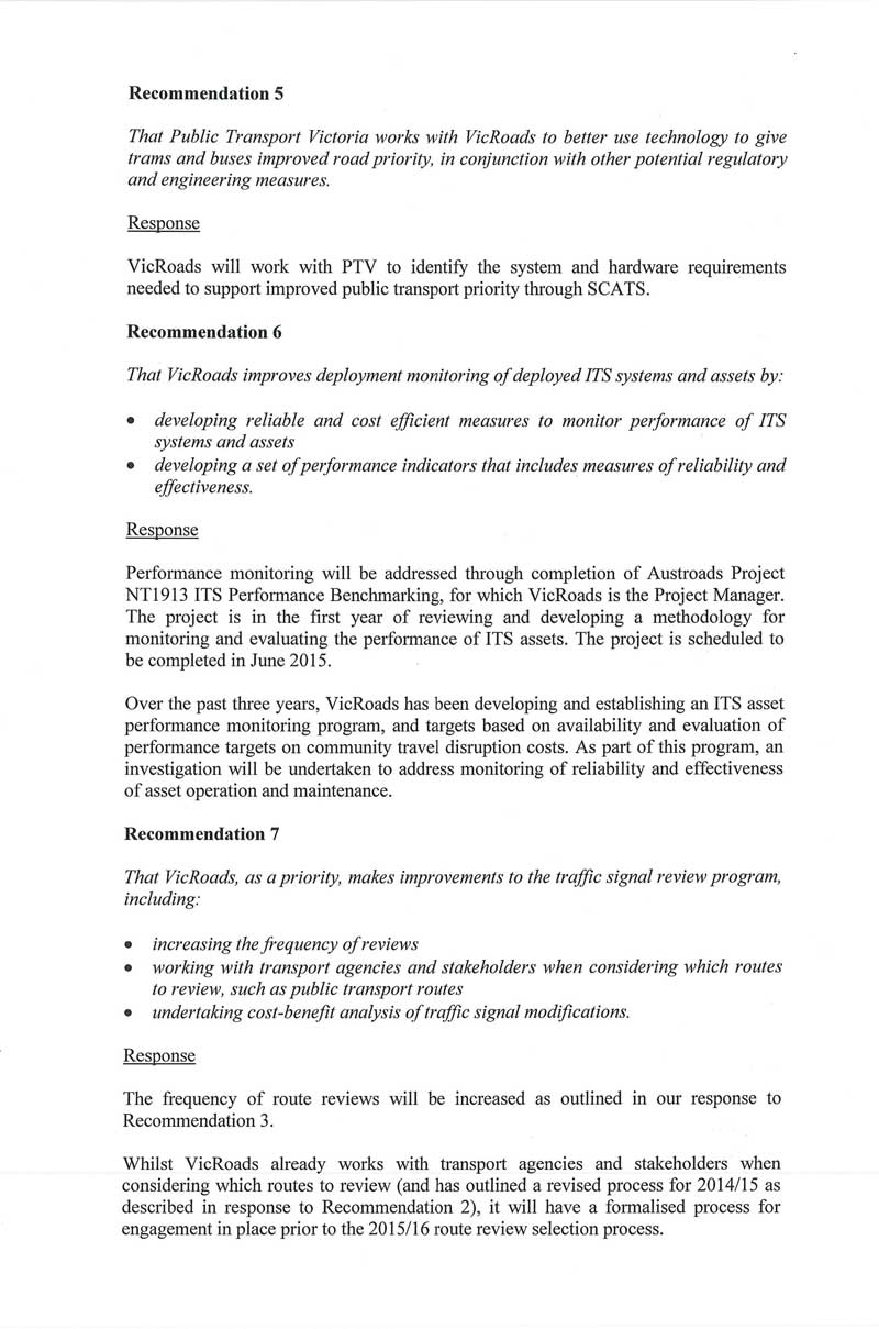
- works with VicRoads to better use technology to give trams and buses improved road priority, in conjunction with other potential regulatory and engineering measures.
That VicRoads:
- improves performance monitoring of deployed intelligent transport systems and assets by:
- developing reliable and cost efficient methods to monitor performance of intelligent transport systems and assets
- developing a set of performance indicators that includes measures of reliability and effectiveness
- as a priority, makes improvements to the traffic signal review program, including:
- increasing the frequency of reviews
- working with transport agencies and stakeholders when considering which routes to review, such as public transport routes
- undertaking cost-benefit analysis of traffic signal modifications
- to better inform decisions, evaluates the costs and benefits of the further deployment of intelligent transport system assets such as ramp metering, variable message signs, and reversible traffic lanes.
Submissions and comments received
In addition to progressive engagement during the course of the audit, in accordance with section 16(3) of the Audit Act 1994 a copy of this report, or relevant extracts from the report, was provided with a request for submissions or comments to the:
- Department of Transport, Planning and Local Infrastructure
- Public Transport Victoria
- VicRoads.
Agency views have been considered in reaching our audit conclusions and are represented to the extent relevant and warranted in preparing this report. Their full section 16(3) submissions and comments are included in Appendix A.
1 Background
1 Background
1.1 Introduction
Road congestion causes delays and frustration for commuters. As Victoria's economy and population keeps growing, congestion is expected to get worse, particularly in Melbourne and other urbanised areas.
Although Victorian roads are not as severely congested as other international localities, traffic congestion is widely perceived as a serious and growing concern for Victorian businesses and individuals.
Congestion occurs when the demand for road use is greater than the capacity of the available road space and also when road incidents take place, impeding the efficient movement of traffic. Once road capacity is exceeded, traffic flow breakdown occurs, resulting in declining average speeds and increasing driver frustration.
The causes of congestion are complex and are driven by both 'supply-side' factors (e.g. limited road space) and 'demand-side' dynamics such as economic and population growth, land-use planning and people's decisions regarding housing and business.
The aim of traffic management is to optimise the use of existing road infrastructure and maintain high levels of mobility and accessibility. ICT-enabled traffic management systems, often described as intelligent transport systems (ITS), are designed to increase the operational efficiency of road networks and are used extensively in traffic management.
1.1.1 Growing road congestion in Melbourne
The demand for travel in metropolitan Melbourne has grown significantly since the early 2000s. In line with Victoria's population increase of 20 per cent from 2002 to 2012 from 3.5 million to 4.2 million, VicRoads data shows that vehicle kilometres travelled has increased by 16 per cent, or an additional 3.8 billion kilometres over that decade.
This jump in demand has resulted in increased road use in Melbourne and is characterised by slower speeds, longer travel times and significant vehicle queuing. This also contributes to unpredictable journey travel times, including for the tram and bus system, which competes for the same road space as private cars and other vehicles.
Previously, Melbourne's low density development had allowed road traffic to increase without much observable congestion. However, this model of urban expansion, which is heavily dependent on car-based travel patterns, is increasingly unable to cater for the type and frequency of journeys that people are making on a daily basis.
In 2006, the Victorian Competition and Efficiency Commission (VCEC) estimated that the economic cost of Melbourne's congestion was in the range of $1.3 billion to $2.6 billion per year, and that this was likely to double by 2020.
Traffic congestion is most significant in and around Melbourne, where VicRoads and transport industry groups estimate that 50 per cent of traffic volume is concentrated on only 3 per cent of the road network during morning and afternoon peak periods.

Image courtesy of TK Kurikawa/Shutterstock.com.
VicRoads data for the 10 most congested intersections with traffic signals in 2013 for the AM and PM peak periods is shown in Figure 1A.
Figure 1A
Most congested intersections 2013, AM and PM peak
AM Peak |
PM Peak |
|
|---|---|---|
1 |
City Road/ Power Street |
Princes Highway/ Warrigal Road |
2 |
Princes Highway/ Warrigal Road |
Maroondah Highway/ Dorset Road/ Bellara Drive/ Exeter Road |
3 |
Sydney Road/ Albion Street |
Warrigal Road/ North Road |
4 |
Warrigal Road/ North Road |
Greensborough Highway/ Grimshaw Street |
5 |
Punt Road/ Swan Street |
Hoddle Street/ Victoria Street |
6 |
Alexandra Parade/ Queens Road/ Brunswick Street |
Doncaster Road/ Tram Road/ Williamson Road |
7 |
Springvale Road/Ferntree Gully Road |
City Road/ Power Street |
8 |
Ferntree Gully Road/ Brandon Park Drive |
Burgundy Street/ Rosanna Road/ Lower Heidelberg Road |
9 |
Greensborough Highway/ Grimshaw Street |
Springvale Road/ Canterbury Road |
10 |
Heidelberg Road/ Chandler Freeway/ Grange Road |
Eastern Freeway/ Nicholson Street/ Princes Street |
With road use continuing to increase, the capacity of Melbourne's road network is being exceeded for longer periods on a daily basis. Travel times have increased and average speeds have reduced in and around Melbourne and other activity centres.
The current average travel speed in the morning peak is 35 kilometres per hour (km/h). Government documentation estimates that without intervention, traffic on Melbourne's current road network could have an extra 390 000 hours of delay in the morning peak period, with average speeds dropping across the whole metropolitan network to 20 km/h by 2021.
The trend in average travel speed over the 10 years from 2002–03 to 2012–13, using VicRoads data illustrates the impact of population growth on network performance.
Figure 1B shows a trend decrease of 1.9 km/h in the average travel speed in the morning peak, 4.4 km/h in the afternoon peak and 3.4 km/h in the off-peak periods.
Figure 1B
Travel speeds in metropolitan Melbourne,
yearly averages and trends over time
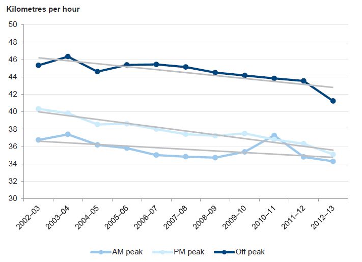
Source: VicRoads Traffic Monitor 2012–2013.
1.1.2 Modes of Travel
Figure 1C shows the various modes of travel used by Victorians.
Figure 1C
Modes of travel
Private cars |
|---|
On a normal weekday, nearly 14 million trips are made across Melbourne. Nearly 80 per cent are made by cars, with an average of 1.2 persons per car. | Public transport |
Melbourne public transport patronage grew by 62.7 per cent from 1998–99 to 2011–12 from 329.9 million to 536.8 million passenger trips. Melbourne's congestion problem is also complicated by public transport legacy infrastructure. |
Trains |
Melbourne's rail network provides nearly 2 000 passenger rail services daily and had 222 million passenger boardings in 2011–12. Melbourne has 180 railway level crossings which can cause significant traffic congestion during peak periods. For example, more than 20 rail services go through the St Albans and Murrumbeena train stations in the AM peak period, and the boom gates can be closed for up to 50 minutes during the two-hour peak period. |
Trams |
Melbourne's tram network is the largest in the world and had 191.6 million passenger boardings in |
Buses |
Over 200 bus routes serve metropolitan Melbourne with 123.2 million passenger boardings in 2011–12. Most services operate in the middle and outer suburbs, with only a relatively small number of routes serving the CBD and inner suburbs. The use of metropolitan bus services has increased by 37 per cent over the past 10 years. | Walking and cycling |
Between 2001 and 2011, the number of people walking to work increased by 50 per cent. Walking accounted for 3.4 per cent of all trips to work in 2011. Between 2001 and 2011, the percentage of people who rode a bicycle to work, or for a part of the journey, increased from 1.2 per cent to 1.8 per cent. |
1.2 Victorian Government strategies and initiatives
1.2.1 Plan Melbourne – the metropolitan planning strategy
In May 2014, the Victorian Government released a policy document outlining a strategy for the future of transportation, as well as residential, commercial and industrial development in Melbourne.
Plan Melbourne provides several high-level objectives to manage congestion and prioritise the highest productivity road users on Melbourne's transport system.
Short-term objectives include:
- preparing a road-use strategy to ensure that trams and buses can operate efficiently alongside other vehicles, particularly as land use changes
- utilising improved technology to manage traffic flows and give trams greater priority on the road network
- investigating dynamic overhead lane management systems to prioritise buses
- publishing metropolitan land use, transport, infrastructure and services datasets to help individuals and businesses make better informed decisions.
In the medium and long term, the objectives include:
- investigating new road management technology systems to improve bus priority
- rolling out managed motorway technology across the metropolitan freeway network.
1.2.2 SmartRoads
VicRoads developed the SmartRoads framework in 2010 to manage competing demands for scarce road space. SmartRoads prioritises certain modes of transport on particular routes according to the surrounding land use and time of day.
Rather than prohibit specific modes of transport from using a particular route, SmartRoads aims to support better outcomes for priority transport modes—providing incentives for users to select the most sustainable transport mode.
VicRoads has developed 31 Network Operating Plans (NOP) for each of the local council areas within metropolitan Melbourne. The NOP for each local council area maps the allocation of SmartRoads priorities for particular modes of transport.
ICT has its part to play in achieving these objectives by:
- allowing traffic signal priority for road-based public transport
- reducing delays for pedestrian traffic, including through dynamic pedestrian crossings
- providing variable speed limits supporting adjacent land use
- improving signal coordination and more active management of motorways
- providing real-time traffic information to commuters.
Intersections are the primary control points for implementing the NOP prioritisation, as these are the main interface between traffic control systems and road users.
1.3 Intelligent transport systems
Intelligent transport systems use ICT to manage road networks and reduce congestion by coordinating traffic and improving safety and travel times.
VicRoads uses two primary types of ITS for traffic management in Victoria's major cities—the Sydney Coordinated Adaptive Traffic System (SCATS) for arterial roads, and STREAMS for freeways.
1.3.1 Sydney Coordinated Adaptive Traffic System
SCATS was developed in New South Wales in the 1970s and has been used in Melbourne since 1982.
SCATS has a central management and monitoring system that collects, stores and analyses data relating to faults, alarms, traffic counts, travel times and congestion. The central system is connected to regional computer units, which coordinate a network of local controllers—roadside cabinets—at each set of signals.
Each regional computer unit typically has four predetermined programs that operate at each intersection, depending on the level of congestion.
To adapt to changing conditions, the system uses historical data from the previous three traffic cycles to change to another predetermined program when certain conditions are met.
1.3.2 STREAMS
In 2007, VicRoads piloted coordinated ramp metering using STREAMS for the Monash Freeway M1 corridor between High Street, Glen Iris and Ferntree Gully Road, Mulgrave.
Following this pilot, STREAMS was expanded and implemented in 2010 as part of the M1 upgrade from Werribee to Narre Warren, and is now being rolled out along the M80 Metropolitan Ring Road.
The STREAMS active freeway management system provides several tools for VicRoads to manage Melbourne's motorways:
- Adaptive ramp metering—the number of vehicles per hour is monitored in each lane, and traffic entering via on-ramps is regulated according to an algorithm. This helps to smooth congestion and prevent flow breakdown. Ramp metering beyond these actively managed sections of the freeway use a set timer so are not adaptive to true conditions.
- Variable speed limits—speed limits can be remotely adjusted by the Traffic Management Centre in response to an incident on the freeway. Variable speed limits are also used in conjunction with lane management symbols to lower the traffic speed and open an extra lane in the verge if required.
- Lane management—is used to dynamically open and close lanes in response to traffic conditions. Lane management can also be used during an incident to close a lane and provide a lane for emergency services to quickly attend the scene.
- Variable message boards—Message boards can inform road users about incidents, travel time, diversions, or display safety messages or public service announcements, such as informing motorists about total fire ban days.

Example of a variable message board.
Photograph courtesy of Rob Tilley via Expressway http://expressway.paulrands.com.
- Real-time traffic information—Drive time signs inform motorists about expected travel times and use a colour-coded indicator of congestion levels on major freeways—green for light traffic, yellow for medium and red for heavy. Signs are located on freeways, as well as feed-in locations on arterial roads.

Examples of a real-time traffic information board.
Photograph courtesy of VicRoads.
- Vehicle detection—STREAMS collects data from road counters to monitor traffic volume. This data is fed into the algorithm for the adaptive ramp entry signals.
- Integration of on-ramps with traffic signals—traffic volume is monitored, and the on-ramp is given priority at the traffic signals on the connecting arterial road to stop traffic queues on the arterial road from blocking access to the freeway.
1.4 Roles and responsibilities
The Department of Transport, Planning and Local Infrastructure
The Department of Transport, Planning and Local Infrastructure (DTPLI) is responsible for the policy development, planning and delivery of transport initiatives and has a key leadership and coordination role in managing Melbourne's traffic congestion.
Public Transport Victoria
Public Transport Victoria (PTV) is a statutory authority managing Victoria's public transport network, which comprises train, tram, bus and regional coach services. These services are provided by independent operators through contracts managed by PTV.
PTV reports to government on the performance of the public transport system and whether passenger services are meeting contractual and community expectations.
VicRoads
VicRoads plans, develops and manages the state's arterial road network and is responsible for traffic management across regional and metropolitan Victoria.
It also manages key road infrastructure projects, and develops and implements plans to improve road access and efficiency.
VicRoads Traffic Management Centre
VicRoads operates a 24-hour Traffic Management Centre (TMC) every day of the year. TMC staff monitor data from SCATS, STREAMS and some contracted 'probe' vehicles, as well as traffic information services from commercial providers.
The TMC provides real-time traffic information to road users in a variety of ways. Representatives from the media and satellite navigation services are present in the TMC to relay information to road users via radio, television and in-car systems.
Traffic engineers on duty at the TMC are able to manually override traffic signals in SCATS to clear congestion. SCATS and STREAMS can alert operators to unusual congestion to focus attention on areas that would most benefit from manual override.

VicRoads Traffic Management Centre. Photograph courtesy of VicRoads.
1.5 Previous Managing Traffic Congestion audit
In April 2013, VAGO's performance audit, Managing Traffic Congestion, found that VicRoads' efforts to improve traffic efficiency through initiatives to better manage road space had shown encouraging results.
However, the lack of clear performance data for network efficiency and congestion management, including arrangements to implement SmartRoads and traffic signal reviews, is impeding VicRoads' ability to optimise the efficiency of existing roads.
The audit recommended that VicRoads:
- develop a strategy—including time frames—for implementing and activating SmartRoads priorities across the metropolitan road network
- improve the frequency and targeting of its traffic signal reviews
- systematically review the efficiency and effectiveness of its operational management of the road system
- develops measures and targets for network efficiency and congestion management initiatives in consultation with stakeholders.
VicRoads' progress in actioning these recommendations was considered as part of the conduct of this audit.
1.6 Audit objective and scope
The objective of this audit was to assess the effectiveness of VicRoads' management of the ICT systems it uses to improve traffic flow outcomes on Melbourne's arterial road system and freeways.
The audit examined whether:
- current ICT roads management systems are operating efficiently, and whether reviews and optimisation of these systems are effective in improving traffic flow
- road management ICT initiatives and plans are effective and clearly link with broader strategic objectives to improve traffic flow.
The audit focused on DTPLI as the department with a key leadership and coordination role in managing Melbourne's traffic congestion as well as urban, transport and land‑use planning.
PTV and VicRoads were examined in their role as agencies responsible for planning, developing and managing Melbourne's public transport and arterial road network.
1.7 Audit method and cost
We examined documents held by DTPLI, PTV and VicRoads and interviewed staff from these agencies.
We also used other official documents and published research as required. The audit team attended and observed operations at the VicRoads Traffic Management Centre and the Yarra Trams Operations Centre.
The audit was performed in accordance with the Australian Auditing and Assurance Standards. Pursuant to section 20(3) of the Audit Act 1994, unless otherwise indicated any persons named in this report are not the subject of adverse comment or opinion.
The total cost of the audit was $355 000.
1.8 Structure of the report
The report is structured as follows:
- Part 2 examines planning ICT traffic management.
- Part 3 examines ICT traffic management systems.
2 Planning ICT traffic management
2 Planning ICT traffic management
At a glance
Background
The aim of traffic management is to optimise the use of existing road infrastructure to maintain high levels of mobility and accessibility. ICT-enabled traffic management systems—often described as intelligent transport systems (ITS)—are designed to increase the operational efficiency of road networks.
Conclusion
The Department of Transport, Planning and Local Infrastructure (DTPLI), Public Transport Victoria (PTV) and VicRoads have not strategically planned to deploy ICT traffic management to complement broader statewide integrated transport and land-use initiatives. Tram and bus tracking systems cannot communicate with VicRoads' traffic signals systems. This limits VicRoads' ability to provide efficient public transport traffic signal prioritisation.
Findings
- Despite previously agreeing to develop a congestion management plan, DTPLI will instead address congestion under the broader objectives of transport and land-use strategies.
- VicRoads is unable to provide assurance that it is optimising the use of its traffic management systems, or whether it has the right ITS assets in the right place.
- Trams and buses are unable to communicate effectively with the Sydney Coordinated Adaptive Traffic System (SCATS), which means VicRoads is unable to provide traffic signal priority when most required or effective.
Recommendations
- That DTPLI, PTV and VicRoads develop a statewide traffic management strategy.
- That VicRoads develops a work program to ensure that traffic signals are consistent with SmartRoads network operating plans and reviews how its internal resource allocation decisions are impacting its ability to effectively manage traffic.
- That PTV works with VicRoads to better use technology, as well as other regulatory and engineering measures, to give trams and buses improved road priority, and upgrades the reliability of bus and tram ICT systems communications and interface with SCATS to enable more effective public transport prioritisation.
2.1 Introduction
Congestion occurs when the demand for road use is greater than the available road space, and when road incidents take place, impeding the efficient movement of traffic. Once road capacity is exceeded, traffic flow breaks down, resulting in decreased average speeds and increased commuter frustration.
The aim of traffic management is to optimise the use of existing road infrastructure and preserve high levels of mobility and accessibility. ICT-enabled traffic management systems—often described as intelligent transport systems (ITS)—are designed to increase the operational efficiency of road networks.
This Part examines whether ICT initiatives and plans are effective and clearly link with broader strategic objectives to improve traffic flow, and whether current ICT systems are operating efficiently.
2.2 Conclusion
The Department of Transport, Planning and Local Infrastructure (DTPLI), Public Transport Victoria (PTV) and VicRoads have not strategically planned to deploy ICT traffic management to complement broader statewide integrated transport and land‑use initiatives.
VicRoads has not strategically or appropriately planned its use of ICT traffic management systems, and is unable to provide assurance that it is using its systems effectively or whether it has what it needs to manage traffic flow.
This audit has also found that trams and buses cannot provide accurate and reliable reference data to VicRoads traffic signals systems. This limits VicRoads' ability to provide efficient public transport traffic signal priority.
2.3 Statewide traffic management planning
There is no overarching statewide strategy clearly laying out the government's approach to addressing traffic congestion in Victoria.
VAGO's 2013 Managing Traffic Congestion audit found that although the state continually invests in initiatives to relieve congestion, it does so in the absence of a statewide plan with clearly defined objectives, strategies and associated agency responsibilities.
The audit recommended that DTPLI, then the Department of Transport, 'in collaboration with other transport agencies, develops a congestion management plan within the context of broader transport and land use strategies which sets out statewide objectives, priorities, targets and agency responsibilities'.
DTPLI accepted this recommendation in principle, but noted that this is ultimately for government to consider. DTPLI has since indicated that it does not support this recommendation and will instead continue to address congestion management under the broader objectives of transport and land-use strategies.
In the absence of an overarching congestion management plan, agency initiatives largely continue to occur in silos with limited consultation or coordination and without monitoring and reporting on the achievement of objectives.
2.3.1 ICT traffic management
VicRoads plans, develops and manages the state's arterial road network and is responsible for traffic management across regional and metropolitan Victoria. It also manages key road infrastructure projects, and develops and implements plans to improve road safety, access and efficiency.
VicRoads uses a wide range of ICT traffic management systems, or ITS, to actively manage traffic. Australia has a long history of pioneering the development and implementation of traffic signal technologies and VicRoads has generally put these to good use.
However, the development of a statewide strategic document on traffic management would ensure that VicRoads' efforts are in line with broader government policies and objectives, and clarify the role and expectations for ICT traffic management systems in addressing congestion.
2.3.2 Plan Melbourne
The Victorian Government's metropolitan planning strategy Plan Melbourne, released on 19 May 2014, proposes several high-level objectives to manage congestion and prioritise the highest productivity road users on Melbourne's transport system. The improvement of on-road priority for buses and trams are set as short- and medium‑term initiatives for DTPLI.
Pursuant to Plan Melbourne, the following strategic documents are currently being developed:
- Road Use Strategy for trams and buses to operate efficiently alongside other vehicles, which is being led by VicRoads
- Network Development Plan—On-Road Public Transport, which is being led by PTV.
However, PTV has not initiated work to give trams and buses greater on-road priority by using improved technology—this is evident in its recent procurement strategy for bus tracking technology, which did not require the new systems to interface with the Sydney Coordinated Adaptive Traffic System (SCATS) to allow for prioritisation of public transport on roads.
2.4 VicRoads' ICT traffic management planning
2.4.1 SmartRoads
In 2010, VicRoads launched the SmartRoads strategy, which provides a 'road use hierarchy' for the state's road network. It outlines how road-based transport should be prioritised according to mode, place, and time of day to maximise throughput of people, not just vehicles. These priorities have been assigned to roads across the network in the form of Network Operating Plans (NOP) developed in consultation with local councils for 31 local government areas across Melbourne. VicRoads advised that SmartRoads underpins its decisions that impact on the performance of the road network.
SmartRoads recognises the increasing role that buses, trams, trucks and bicycles play in moving people and freight around the road network. It also recognises that good access for pedestrians needs to be a key element of the transport system.
ICT traffic management systems are used to translate SmartRoads principles and priorities into road system operations.
Network operating plans
An NOP is used to determine whether proposed changes to intersections meet the requirements of the SmartRoads guidelines. NOPs identify the function of each arterial road and the level of priority that each transport mode should be given to promote efficient traffic patterns.
A software tool—the Network Fit Assessment tool—is used to determine whether proposed changes support the intent of the NOP and SmartRoads. The assessment includes all of the roads and intersections that are likely to be affected by the proposal for all time periods across the day or for a specific time period that the proposal is targeting—e.g. the AM peak. Each transport mode—trams, buses, freight, bicycles, pedestrians and cars—is assessed at each intersection.
A pre- and post-assessment is carried out by VicRoads to make sure that any proposed modifications to the traffic signals align with SmartRoads principles and guidelines. This is then confirmed by consultation with key internal and external stakeholders.
Minimal implementation progress
Since SmartRoads was implemented in 2010, VicRoads had done little to ensure that traffic signals across Victoria were consistent with NOPs. But from 2013, VicRoads made it mandatory for all route reviews and new major project proposals to align with the relevant NOP.
Nevertheless, beyond new route reviews and new major project proposals, there is no proactive implementation of SmartRoads NOPs for the majority of other traffic signal sites. To date, VicRoads estimates that less than 10 per cent of traffic signals have been adjusted to align with NOPs.
VAGO's 2013 Managing Traffic Congestion audit recommended that VicRoads develop a strategy for implementing NOPs and activating SmartRoads priorities across the metropolitan road network. VicRoads accepted this recommendation and advised that it is an action in Plan Melbourne and that it has commenced working with DTPLI and PTV on its implementation.
Given that VicRoads considers SmartRoads to be a major driver for its road network decisions, it should consider how its resourcing decisions are impacting its ability to proactively implement SmartRoads across the remaining 90 per cent of traffic signal sites.
2.4.2 ITS asset management and enabling strategy
Prior to November 2013, VicRoads had no plan to guide how it should optimise the use and management of its ITS assets and systems.
This lack of planning means that VicRoads has had to deal with issues such as:
- inconsistent, unreliable and hard to manage ITS systems and assets
- difficult and costly integration of different legacy technologies
- legacy assets which are incompatible with new technology
- no direction to guide technology choices and upgrade/renewal of ITS assets
- increased operating and maintenance costs due to ageing technology.
In response to this problem, VicRoads developed the ITS asset management and enabling strategy (the strategy) in November 2013.
Principles of the strategy
The strategy sets out principles for VicRoads to follow in ITS life cycle management—i.e. from procurement, implementation, operation and maintenance to decommissioning of ITS assets and systems. The principles are:
- before purchasing new systems, use and develop existing ITS infrastructure systems and maintain ITS infrastructure to a level that is consistent with the strategy objectives
- develop annual ITS asset maintenance plans that maximise the life of the ITS infrastructure and device, and improve operational efficiency
- apply risk management to optimise the availability and serviceability of ITS infrastructure and devices
- create consistent ITS standards that leverage best industry, national and international practices
- promote emerging ITS technologies where there are demonstrated road system benefits
- adopt a whole-of-life approach to ITS investment planning and architecture governance and assurance.
Required action policies and guidelines
The strategy states that a number of action policies and guidelines will be developed to achieve the following outcomes:
- provide an efficient and sustainable ITS network that services VicRoads' business requirements throughout the asset life cycle
- enhance the ITS asset maintenance regime to meet service delivery needs
- provide accessibility of data and information in collaboration with stakeholders to aid decision-making.
While the development of the strategy is a positive step, detailed supporting policies and guidelines are not yet developed. The strategy does not say when these guidance documents will be completed, although VicRoads advises that it is finalising the time frames for their completion.
2.4.3 No fully developed strategic plan
Because VicRoads is yet to fully develop its 2013 ITS strategy, it is unable to provide assurance that it is optimising the use of its systems and that it has what it needs to effectively manage traffic.
For example, VicRoads is unable to confirm that it has the appropriate number of closed-circuit television (CCTV) cameras or traffic management operators to effectively monitor and manage the road network.
Closed-circuit television
VicRoads has 348 CCTV cameras, with 213 of these located along freeways and the remaining 135 at arterial road intersections. Some of these cameras are also able to provide imagery for more than one intersection.
This means that approximately 5 per cent of signalised traffic intersections across Victoria are able to be monitored by CCTV.
CCTV provides live video of traffic conditions to staff at VicRoads' Traffic Management Centre (TMC). The TMC operators rely heavily on CCTV to help them understand real conditions and better manage traffic.
SCATS and other ITS systems are able to alert TMC staff that there may be unusual congestion or an incident at a particular traffic intersection, but imagery from CCTV cameras confirms the actual situation.
VicRoads has advised that, in their view, there is no optimal number of CCTV cameras required to manage traffic. However, VicRoads also acknowledges that it does not have an assessment tool or set of criteria to guide decisions on whether the CCTV cameras it has deployed are sufficient or whether current CCTV cameras are located at intersections where they are of greatest benefit.
Traffic management operators
VicRoads is unable to confirm whether it has sufficient traffic management operators to efficiently and effectively manage traffic.
A benchmark study (the study) it commissioned for a major augmentation to the metropolitan road network shows that compared to other Australian states and developed countries, VicRoads has significantly fewer traffic management operators per kilometre of distance travelled.
The study defined a traffic management operator as a person whose sole responsibility is to manage traffic systems and implement measures to manage traffic on the road network.
The study compared traffic operators' workload across a number of jurisdictions. The VicRoads ratio of 39.1 travelled million kilometres per operator per day (TMK/O) is more than twice that of Western Australia, which has a ratio of 18.4 TMK/O and nearly four times that of Netherlands, with 9.83 TMO.
This means that each VicRoads operator is managing two to four times more travelled road kilometres than traffic operators in other jurisdictions.
Similar to the situation with CCTVs, VicRoads is unable to confirm whether it has the appropriate number of traffic operators to effectively manage traffic. Conversely, it cannot confirm whether it could better manage traffic on Victorian roads and reduce the costs associated with congestion by increasing the number of staff.
A fully developed ITS strategy may better inform VicRoads about the staffing and asset resources that it requires. VicRoads should also look into how other jurisdictions use their existing staff and resources to achieve traffic management outcomes, including whether there are better practices or innovations that could be adopted in Victoria.
2.5 Traffic signal priority for trams and buses
A major limitation of the metropolitan traffic system is the management of public transport. This is due to several factors, including the need to operate public transport vehicles in mixed traffic with competing priorities, and limitations with the legacy technology used in public transport vehicle tracking systems.
To promote the use of public transport and assist trams and buses to cross traffic intersections more efficiently, a traffic signal priority program was commenced in the 1980s by VicRoads.
Under the traffic signal priority program, trams and buses are able to get traffic light priority in SCATS, irrespective of whether they are running early or late. SCATS transponder loops are able to detect a tram or bus and are able to extend the green light or reduce the red light time to allow the tram or bus to cross the intersection sooner.
At some intersections, tram signals (T lights) and bus signals (B lights) have been installed so the tram or bus can enter the intersection before the traffic lights turn green for other traffic.
Currently, the ICT systems used to track trams and buses are not able to communicate or interface appropriately with SCATS. DTPLI and PTV have not yet solved this ineffective system interface.
Consequently, VicRoads is unable to provide 'conditional' traffic signal priority to public transport—that is, priority only when required, such as when a tram or bus is running behind schedule.
2.5.1 Tram priority

At present, priority for trams is not effective and can cause inefficient and protracted red light time for tram passengers.
The Think Tram program was launched in 2004 by VicRoads in partnership with PTV and Yarra Trams. The aim of the $30 million program was to increase patronage by improving tram travel times and reliability, accessibility and safety along the busiest tram routes around Melbourne.
Under the program, a number of road-based improvements were made, such as installing platforms, part-time tram lanes, turn bans, hook turns, roundabout modifications and traffic signal modifications.
PTV documentation states that these initiatives led to travel time improvements. For example, changes to tram priority on Clarendon Street in South Melbourne by implementing hook turns and right hand turn bans was observed to improve traffic flow in both directions.
PTV documentation shows that because of these modifications, trams travelling towards the city had a trip time reduction of up to 180 seconds during the AM Peak, and trip savings as high as 45 seconds during the remainder of the day. Trams travelling from the city towards St Kilda saw similar savings of around 45 seconds throughout the course of the day.
The Think Tram program has now ceased, and PTV documentation states that many of these previous improvements have now been lost due to increasing congestion and higher tram patronage.
Need for improved public transport ICT systems.
Although they predominately operate in the inner and middle suburbs, trams cater for 35 per cent of all public transport boardings and over 10 000 daily work-related trips.
The cities of Melbourne, Port Phillip and Yarra generate about 30 per cent of the gross state product, and with central Melbourne expanding beyond the 'Hoddle Grid', a growing number of trips are beyond walking distance, increasing reliance on trams as a quick transport mode.
Although transport links are integral to providing access for business-to-business interactions, PTV documents state that Melbourne has one of the 'slowest and most unreliable' tram networks in the world.
PTV documentation shows that trams in the United Kingdom and France spend from 1 to 3 per cent of their journey time at traffic signal intersections, compared to Melbourne's 17 per cent.
Melbourne has the largest tram network in the world and about 80 per cent of the network shares road space with general traffic, which is more than any other light rail network in the world.

Photograph courtesy of ChameleonsEye/Shutterstock.com.
PTV data also shows that in 2013, the average tram speed across Melbourne was 16 kilometres per hour (km/h) and has continued to decline compared to previous years. Sydney Road and Chapel Street have tram speeds as low as 6 km/h at busy times of the day, which is marginally above walking speed and slower than bicycle riding. The typical speed in the central business district is 10.5 km/h.
Slow trip times during peak periods mean that more trams are required to operate the set timetable. In addition to the high outlay on tram rolling stock and ongoing operating costs, slow and unreliable public transport can lead to more people abandoning the public transport mode option and using private vehicles, which further exacerbates the road congestion problem.
Tram delays are also encountered at intersections—caused by high volumes of right‑turn traffic. PTV believes that initiatives, including the wide adoption of hook turns, could assist the movement of trams, as the Think Tram program previously showed.
Updating tram technology to real-time tracking and improving tram priority at signalised intersections could also boost tram performance by providing faster and more reliable services that are given priority when needed.
Limitations with detection systems
Melbourne's tram network uses a loop detector system which relies on sensors installed in the road pavement to detect the physical presence of a tram.
Priority is triggered by the physical location of the tram, irrespective of whether it is running early, late, or loading or off-loading passengers. This results in protracted red light time for other intersection users, with no benefit to the tram.
If a detector loop fails, signal priority for trams also fails. PTV documentation states that at any point in time, an estimated 10 per cent of tram detector loops do not function, and priority is not provided, causing long delays for trams.
In other jurisdictions, road traffic systems are linked to a tram Automatic Vehicle Monitoring (AVM) system and thus provide a higher degree of accuracy about vehicle status than that provided by a loop-based system. This allows better prediction of vehicle arrival information which is essential to enable traffic signals to give priority when needed, such as when the tram is running behind schedule.
Melbourne's tram AVM system is obsolete and has no interface with the SCATS system. At detection points along the roadside the tram position is known exactly but between these points the tram's odometer is used to estimate its position.
A business case to replace the existing AVM system was approved in the 2009–10 State Budget, and a project to replace the existing system was initiated in August 2009. The project steering committee directed the project to undertake an open tender to source an 'off the shelf' solution for the AVM replacement.
However, PTV later changed its procurement strategy and decided to undertake a 'life extension' project instead. Until a new AVM system is procured and commissioned, the issues described above will continue.
2.5.2 Bus priority
An important difference between bus and tram priority systems is that the position of the bus is usually known more accurately at a larger number of points. This is because instead of using roadside detectors, the system tracks the location of the bus using the global positioning system (GPS), and communicates this data to a control centre or a central computer.
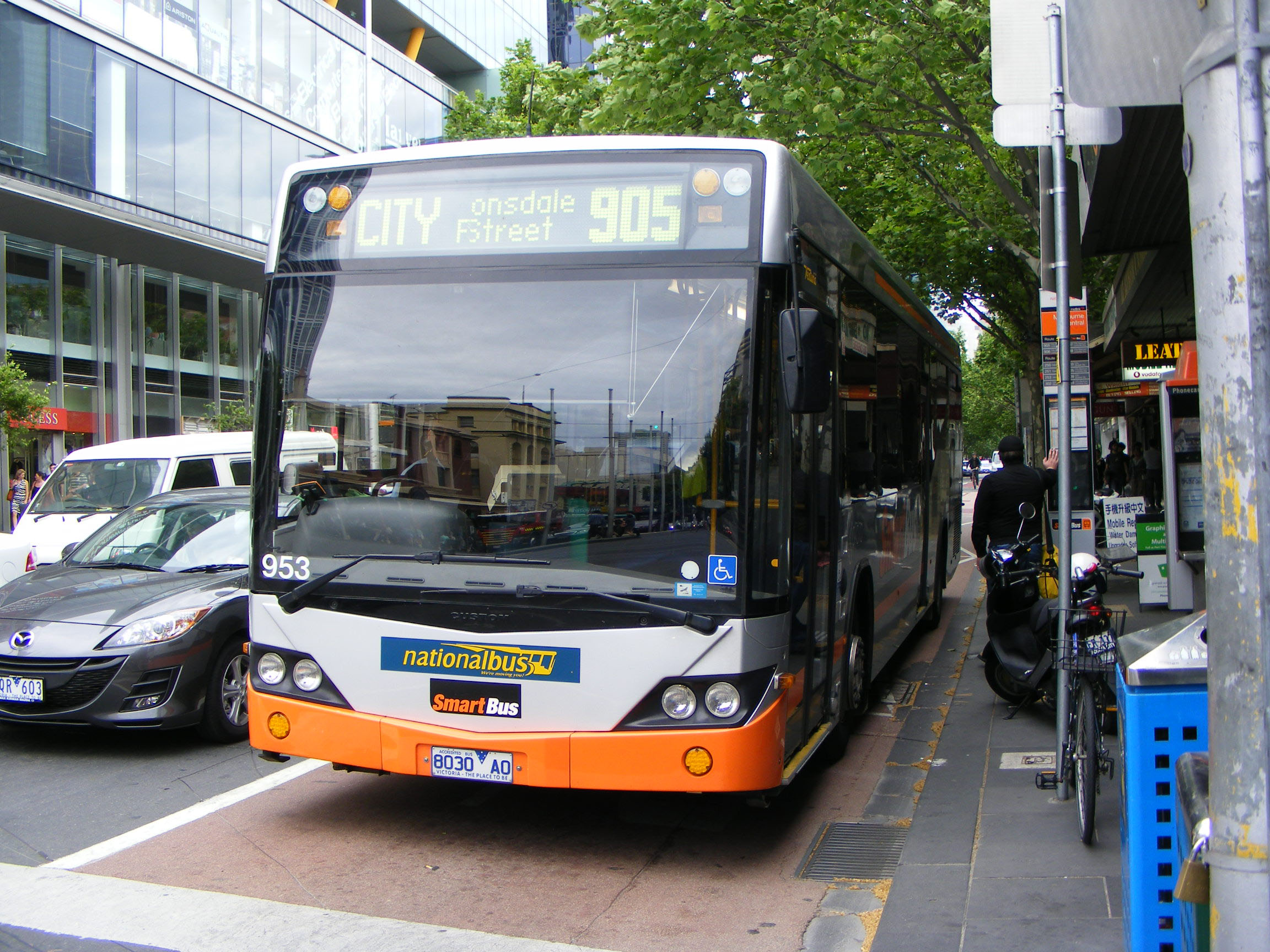
In 2010, GPS bus tracking was adopted for Melbourne's SmartBus routes—which account for about 30 per cent of Melbourne's bus fleet—giving PTV and bus operators real-time visibility of bus locations.
As part of the SmartBus GPS tracking system, a traffic priority system was trialled and interfaced with SCATS. This meant that a SmartBus could be detected by SCATS using GPS positioning data and SCATS could give priority, such as a green light extension, when the bus was running late.
However, this interface with SCATS was disabled in August 2013 because the information provided by the SmartBus GPS technology to SCATS was not reliable. This caused buses to be given priority even when it was not required, thereby causing protracted red light for other commuters.
Photograph courtesy of australia.showbus.com
To address these issues, VicRoads requested PTV to upgrade its bus tracking technology to allow the provision of real time and accurate reference data to SCATS, including location and timetabling. PTV is yet to deliver on this and advised that this is due to time and resource constraints.
This means that since August 2013, no bus in Victoria is interfaced with the SCATS system and buses are unable to get predictive priority in the traffic stream. The only bus priority methods in place at present are bus priority lanes and detector loops to activate a B light, if they are installed at an intersection.
On 27 March 2014, PTV announced that a preferred supplier had been selected to operate the GPS bus tracking system for metropolitan buses. However, the capability to interface with SCATS and provide bus priority was not a requirement of the tender specification for this procurement.
This means that while PTV plans to roll out the new bus tracking system to all depots by July 2014, it will still not enable appropriate and effective bus prioritisation.
It is not clear why the capability to interface with SCATS was excluded from the tender specification. This appears to be a clearly missed opportunity for PTV, VicRoads and bus operators to make this public transport mode more efficient in a heavily congested road system.
PTV advised that although the capability to interface with SCATS was not required in the tender specification, it sought a 'real time GPS data feed from a supplier that had proven integration capability and could fulfil a variety of downstream requirements, including SCATS'.
Recommendations
- That the Department of Transport, Planning and Local Infrastructure, Public Transport Victoria and VicRoads develop a statewide strategic document on traffic management to ensure that VicRoads' efforts are in line with broader government policies and objectives, and to clarify the role and expectations for ICT traffic management systems to help address congestion and priority for road-based public transport.
That VicRoads:
- develops a work program to ensure that traffic signals across the Victorian road network are consistent with network operating plans developed under the SmartRoads policy
- reviews how its internal resource allocation decisions are impacting on its ability to effectively manage traffic in the Victorian road network.
That Public Transport Victoria:
- upgrades and improves the quality and reliability of bus and tram ICT systems communications and interface with the Sydney Coordinated Adaptive Traffic System to enable more effective public transport prioritisation
- works with VicRoads to better use technology to give trams and buses improved road priority, in conjunction with other potential regulatory and engineering measures.
3 ICT traffic management systems
At a glance
Background
VicRoads uses two primary types of intelligent transport systems for traffic management in Victoria—the Sydney Coordinated Adaptive Traffic System (SCATS) for pedestrian and intersection traffic signals and STREAMS for Melbourne's freeways.
Conclusion
ICT traffic management systems deployed by VicRoads are able to detect when traffic is being impeded, and can provide a timely response to help smooth flow. However, their effectiveness is limited when road capacity is increasingly saturated, as is the case for many arterial roads across metropolitan Melbourne. VicRoads has not complied with its own internal guideline to review traffic signals once every five years in order to assess their effectiveness in handling current traffic conditions.
Findings
- Both SCATS and STREAMS are able to monitor traffic volume and automatically adapt timings and phasings to manage the flow of vehicles. However, there is a limitation to what SCATS can realistically achieve in situations where traffic demand consistently exceeds road capacity.
- VicRoads has reviewed an average of 200 traffic signal sites per year for the past six years, or a quarter of the reviews required under the five-year target. At the rate that VicRoads is conducting its reviews, the state's nearly 4 000 traffic signal sites will only be reviewed once every 20 years, instead of every five.
Key recommendations
That VicRoads:
- improves performance monitoring of deployed intelligent transport systems and assets
- makes improvements to the traffic signal review program, including increasing the frequency of reviews and undertaking cost-benefit analysis of traffic signal modifications
- evaluates costs and benefits of further deployment of intelligent transport system assets.
3.1 Introduction
Intelligent transport systems (ITS) use ICT to manage road networks and reduce congestion by coordinating traffic and improving safety and travel times.
VicRoads uses two primary types of ITS for traffic management in Victoria—the Sydney Coordinated Adaptive Traffic System (SCATS) for arterial roads in major urban areas and STREAMS for Melbourne's freeways.
This Part examines whether current ICT systems used for traffic management are operating efficiently, and whether reviews and optimisation of these systems are effective in improving traffic flow.
3.2 Conclusion
ICT traffic management systems deployed by VicRoads are able to detect when traffic is being impeded, and can provide a timely response to smooth flow.
The effectiveness of these traffic systems is limited when road capacity is increasingly saturated, as is the case for many arterial roads across metropolitan Melbourne particularly during morning and afternoon peak periods.
VicRoads has not complied with its own internal guideline to review traffic signals once every five years in order to assess their effectiveness in handling traffic conditions.
At the rate it currently conducts these reviews, VicRoads is likely to only review traffic signals once every 20 years.
3.3 VicRoads' ICT traffic management systems
The two primary ICT traffic control systems used by VicRoads are SCATS for arterial roads, and the STREAMS Freeway Management System (FMS) for freeways. Both SCATS and STREAMS are able to monitor traffic volume and automatically adapt timings and phasings to manage the flow of vehicles.
3.3.1 Critical role in traffic management
ITS plays a critical role in managing traffic. It does this by directing vehicles when and where to go, as well as detecting and enabling a timely response to events that could impede traffic movement.
In the context of increasing pressure for car use on the Victorian road network and a decreasing budget, VicRoads is becoming more reliant on ITS to effectively manage the road network.
The benefits of ICT traffic management systems are self-evident. Traffic intersections turn to gridlock after only a few minutes of traffic signals not working due to a power failure. The closure of the Domain and Burnley tunnels caused by a computer switch fault provides a good example of this and is described in Figure 3A.
Figure 3A
Case study—ITS and the CityLink Domain and Burnley tunnels
|
On 3 October 2012, a computer switch failure closed the CityLink Domain and Burnley tunnels for more than 12 hours. This caused substantial traffic congestion that extended not only along the Monash M1 Freeway but had a flow-on effect across a 20 kilometre radius. The closure of the tunnels meant that more than 120 000 motorists had to use alternative arterial routes on the day. This in turn forced users of these roads onto other routes. The Monash Freeway and Eastern Freeway were gridlocked, as were arterial roads within and around the city. Large parts of South Melbourne, St Kilda, Caulfield, Fitzroy, Collingwood, Brunswick and Flemington were also heavily congested. Journeys that normally took 50 minutes took more than two hours. Trams were caught in the congestion and the rail network was also affected as many commuters sought to avoid the large-scale traffic delays by catching already crowded trains. Government documentation states that the faulty component that caused the shutdown was worth $15 000, but the shutdown cost the CityLink operator millions of dollars in lost toll revenue, and led to significant unmeasured economic costs to Victorian motorists, commuters and the business community. |
Note: The ICT systems used to monitor and manage the Domain and Burnley Tunnels are maintained and operated by the CityLink private operator Transurban, not VicRoads.
Source:Victorian Auditor-General's Office analysis of government documents.
3.3.2 SCATS
SCATS was developed in Sydney in the early 1970s and is one of the most widely used traffic systems in the world. It has been installed in some 150 cities across 27 countries.
Most traffic signal intersections in Australia are SCATS operated, and VicRoads has used the system since 1982. SCATS controls nearly 4 000 traffic signal intersections across the state.
Automatic adjustments of time and phasings
SCATS is able to automatically adjust signal time and phasings in response to changes in traffic conditions. It is capable of clearing sudden and unpredictable traffic build-ups by making continuous adjustments to traffic signal timings—for example, by extending the green light in one direction to allow more vehicles to clear an intersection.
Detector loops are embedded in the road pavement. They are located in each lane near the stop line at traffic intersections and collect data on traffic volume and the length of time it takes for a vehicle to clear the loop. This gives SCATS the data it needs to adjust traffic signal timings.
SCATS is also able to automatically skip a traffic signal phase—for example, it can skip a right turn phase if it does not detect a vehicle in a right turning lane.
Manual adjustments
Although SCATS does not need operator intervention to operate, VicRoads Traffic Management Centre staff can manually override traffic signal control under exceptional circumstances, such as during unusual congestion.
Unusual congestion refers to instances when the degree of saturation (DS)—which is VicRoads' congestion indicator—is equal to, or greater than 95 per cent. This indicator compares the current performance to historical data at the same time of day to flag an unusual congestion event.
3.3.3 The STREAMS Freeway Management System
The STREAMS Freeway Management System is an Australian-developed technology and was first used by VicRoads in 2007 to pilot coordinated ramp metering on the Monash M1 Freeway corridor. This included the implementation of a ramp metering algorithm on a 15 kilometre section of the outbound carriageway.
Based on the positive outcomes from the pilot, the much larger Monash-CityLink-West Gate M1 Upgrade Project installed STREAMS technology—including incident response capability, lane use management, variable speed limit signs, dynamic message signs and CCTV—along the 75 kilometre freeway corridor from Werribee to Narre Warren.
The system is being installed on the M80 as part of the M80 Metropolitan Ring Road Upgrade Project. Victoria has also recently secured a Commonwealth contribution to further roll out of lane use management systems on the M1 corridor.
Although the adaptive ramp metering functionality of STREAMS is only currently installed along the M1 corridor and is being installed on the M80 corridor, VicRoads plans to progressively deploy this system function along other freeways.
Benefits achieved from STREAMS
VicRoads claims that the ramp metering component of STREAMS has delivered substantial benefits, including reduced travel times, reduced accidents and reduced greenhouse emissions.
However, an examination of the review methodology shows that these claimed benefits are not solely attributed to the STREAMS traffic management system, but instead to the overall M1 upgrade project, which included infrastructure capacity improvements such as widening the freeway to provide an additional lane in both directions.
VicRoads acknowledges that it is unable to separately report on the benefits achieved by installing STREAMS from those delivered by the whole project.
Despite this, VicRoads has some understanding of the stand-alone benefits of ramp metering as a result of its ramp metering pilot in 2007. These benefits were:
- economic benefits, estimated at $94 000 per day
- travel time reduced by 42 per cent during peak periods
- travel time reduced by 48 per cent in the CityLink tunnels
- accidents reduced by 30 per cent on the motorway
- accidents reduced by 60 per cent in the CityLink tunnels
- greenhouse gas emissions reduced by 11 per cent.
3.4 Traffic Signal Review Program
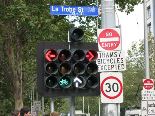
According to VicRoads' Network and Asset Planning Program Guide, each set of traffic signals should be reviewed once every five years to assess their effectiveness in handling current traffic conditions.
Photograph courtesy of Faith Gritten.
The Traffic Signal Review Program is a systematic review of traffic operations and the implementation of low-cost traffic improvements along key urban arterial traffic corridors. Its objective is to reduce travel costs and reduce congestion by achieving smoother and more reliable on-road travel.
International research shows that traffic signal timing improvements arising from reviews of SCATS traffic signals can have a benefit-cost ratio of up to 21:1. However, VicRoads has not conducted this type of analysis and does not calculate the cost‑benefit ratio of its review work.
3.4.1 One review per site every 20 years
The pace of traffic signal reviews conducted from 2007–08 to 2012–13 shows that at VicRoads' current work rate, the state's nearly 4 000 traffic signal sites will only be reviewed once every 20 years, instead of the target of once every five years.
Figure 3B shows the number of traffic signal sites reviewed by VicRoads every year from 2007–08 to 2012–13. This translates to an average of only 200 traffic signal sites reviewed every year—or a quarter of the reviews required under the five-year target. The 2013–14 VicRoads route review program covers a total of 135 traffic signal sites—this is a further 65 reviews short of the 200 yearly average.
Despite the internationally recognised benefits derived from traffic signal reviews, there is no incentive for VicRoads to complete the targeted number of reviews every year. It is only an internal metric, and there is no requirement to report this performance externally or publicly.
Figure 3B
Route reviews conducted from 2007–08 to 2012–13
| Year | Route reviews (number) |
Traffic signal sites included in reviews (number) |
|---|---|---|
| 2007–08 | 3 | 63 |
| 2008–09 | 15 | 210 |
| 2009–10 | 40 | 349 |
| 2010–11 | 18 | 161 |
| 2011–12 | 28 | 370 |
| 2012–13 | 10 | 87 |
| Total | 114 | 1 240 |
Source: Victorian Auditor-General's Office, using VicRoads' traffic route review data.
3.4.2 Better targeting of reviews
VAGO's 2013 Managing Traffic Congestion audit recommended that VicRoads improve the frequency and targeting of its traffic signal reviews.
As shown above, VicRoads has not increased the frequency of route reviews. However, it has started to address improved targeting of these reviews.
VicRoads' selection of traffic signal sites in the 2013–14 work program was based on traffic congestion data—from SCATS and probe vehicles—as well as observations of underperforming intersections, and recent changes in the road network from new roads being built or additional traffic signals being installed.
VicRoads usually coordinates with PTV or public transport operators such as Yarra Trams when selecting and prioritising route reviews. It did not consult stakeholders for reviews planned for 2013–14 due to tight time frames but has now commenced discussions with PTV to determine three additional routes for review.
VicRoads' ICT traffic management systems currently have little to no visibility of the movement of trams and buses across the road network. This limits VicRoads' ability to consider public transport routes for inclusion in its route reviews.
VicRoads could also further improve the targeting of route reviews by actively engaging with community and transport stakeholders.
The lack of a coordinated response to operational route reviews is a missed opportunity to optimise performance of the road network for all modes, not just car‑based traffic. Moreover, the limited number of reviews being conducted is also impeding VicRoads' efforts to make sure traffic signals are consistent with SmartRoads Network Operating Plans.
3.4.3 Effectiveness of route reviews
VicRoads documentation shows that international transport research studies confirm that traffic signal timing modifications arising from traffic signal reviews are estimated to have a benefit-cost ratio of up to 21:1.
Despite this, VicRoads does not conduct such cost-benefit analysis as a matter of course and has not calculated the economic costs and benefits of its route review program.
Figure 3C provides an example of a traffic signal review that resulted in improvements to traffic flow.
Figure 3C
Case study—Improvements from route reviews
|
Enhanced peak hour tram priority—Barkers Road, Kew The Barkers and Glenferrie Road intersection in Kew was selected for review in 2008‑09. This site experienced high traffic volumes with approximately 28 300 vehicles per day on Barkers Road, and 14 000 motor vehicles and 215 tram movements per day along Glenferrie Road. During the AM and PM peak and local school finishing times, Glenferrie Road typically experienced extensive queuing of up to 500 metres in the AM peak and 300 metres during school finishing time, delaying commercial and private vehicles. This in turn delayed trams, as they share the same road space. As a result of the introduction of enhanced peak hour tram priority as part of the review, the Glenferrie Road north-approach traffic queues halved during the AM peak from 500 metres to less than 250 metres. Similarly, delays on the southern approach improved from long stationary queues to a queue of less than 150 metres. Significantly, although the phasing reduced green light time for vehicle traffic on Barkers Road, it remained unaffected following the introduction of the enhanced tram priority, with no or minimal queuing. |
Source: Victorian Auditor-General's Office.
3.5 Degree of saturation
VicRoads uses DS as its main indicator for traffic congestion. DS is calculated by a ratio of vehicle demand versus the capacity of the road.
A DS that is close to 0 per cent indicates little or no traffic flow, and a value of 100 per cent indicates that demand and capacity are equal and therefore no more traffic is able to progress through the intersection.
A DS value greater than 100 per cent indicates over-saturated conditions in which long queues of vehicles have built up on critical approaches. Direct observation of SCATS computer monitors during the audit, showed that DS values of more than 100 per cent occurred frequently during peak and off-peak periods on metropolitan arterial roads.
VicRoads staff advised that values above 95 per cent typically indicate traffic congestion where queues of vehicles will begin to form and drivers need to wait for more than one cycle of traffic lights to pass through an intersection.
SCATS calculates the DS value for each lane at most intersections and is able to make automatic adjustments to promote traffic flow. Traffic Management Centre staff manually intervene and modify traffic signal phasing when the DS value is equal to or greater than 95 per cent. This saturation indicator compares the current performance to historical data at the same time of day to flag an unusual congestion event.
3.5.1 Victoria's most congested traffic intersections
SCATS data for 2011 to 2013 shows the most congested traffic signal intersections where the DS is equal to or more than 95 per cent for the longest period of time, as displayed in Figures 3D and 3E.
Figure 3D
Most congested intersections, AM PEAK
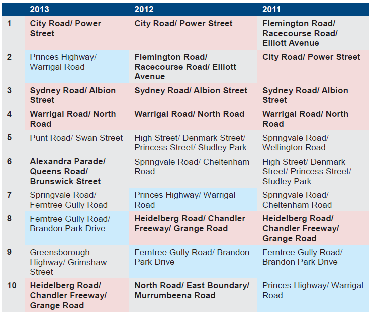
Note: Bold font denotes intersections not subjected to route reviews. Blue shade denotes intersections subjected to route review but consistently remained in the top 10 most congested sites. Pink shade denotes intersections NOT subjected to route review but consistently remained in the top 10 most congested sites.
Source: Victorian Auditor-General's Office, using VicRoads traffic route review data.
Figure 3E
Most congested intersections, PM PEAK
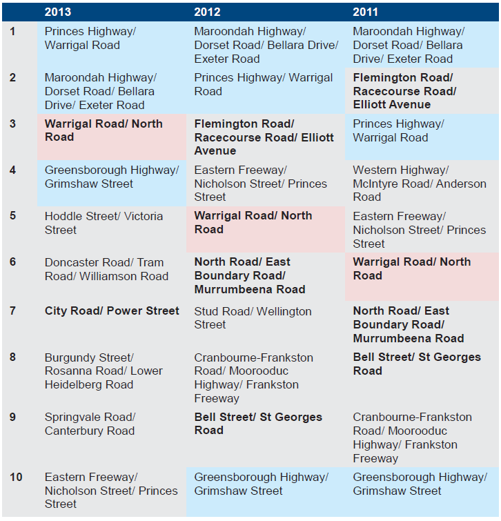
Note: Bold font denotes intersections not subjected to route reviews. Blue shade denotes intersections subjected to route review but consistently remained in the top 10 most congested sites. Pink shade denotes intersections NOT subjected to route review but consistently remained in the top 10 most congested sites.
Source: Victorian Auditor-General's Office, using VicRoads traffic route review data.
Sixty-five per cent of these intersections have been subject to route reviews, and are monitored by Traffic Management Centre staff for manual traffic signal adjustments during the morning and afternoon peak.
From 2011 to 2013, the number of traffic intersections with a DS equal to or greater than 95 per cent for at least 100 hours in the year consistently increased for both the morning and afternoon peaks. This confirms the increasing levels of congestion in metropolitan Melbourne.
Four intersections consistently remained in the top 10 most congested sites for 2011, 2012 and 2013, yet have not been included in traffic route reviews to date, namely:
- Warrigal Road/North Road—AM and PM peak hours
- Sydney Road/Albion Road—AM peak hour
- Heidelberg Road/Chandler Highway/Grange Road—AM peak hour
- City Road/Power Street—AM peak hour.
VicRoads has subsequently advised, however, that the City Road/Power Street intersection will be included in a 2013–14 traffic route review.
Another four intersections remained consistently in the top 10 most congested traffic intersections for 2011, 2012 and 2013, despite being previously included in traffic route reviews. These are highlighted in blue in the above tables:
- Greensborough Highway/Grimshaw Street—PM peak hour
- Princes Highway/Warrigal Road—AM and PM peak hours
- Ferntree Gully Road/Brandon Park Drive—AM peak hour
- Maroondah Highway/Dorset Road/Bellara Drive/Exeter Road—PM peak hour.
Because they continue to reflect a DS of more than 95 per cent, the data shows that although SCATS plays a critical role in optimising traffic flow, there is a limitation to what SCATS can realistically achieve in situations where traffic demand consistently exceeds road capacity.
This means that the ability of ITS to smooth traffic flow in situations of unusual congestion is limited and other demand-side approaches need to be considered to ease congestion during peak periods.
RACV RedSpots
Every two years, the RACV conducts a survey seeking nominations on the most congested traffic intersections. The RACV website refers to a RedSpot as a location on the road or public transport network with unnecessary or excessive congestion that potentially makes road users 'see red'. It is based on nominations from the public, and the 10 traffic intersections that receive the most nominations are designated as RedSpots for the particular year.
Half of the 2012 RedSpots involve railway level crossings where congestion is mainly due to the period of time when boom gates are closed. In this situation, adjustments in SCATS traffic signal phasings can do little to ease congestion.
Even if there were an upgrade of train ICT systems to provide a more accurate and reliable interface with SCATS, it could only result in an incremental improvement to traffic.
This is because railway safe working systems will always require trains to have absolute priority over road traffic at level crossings, and as a signal upgrade is also intended to increase the number of train journeys, it will increase or at least maintain the long period that boom gates are down.
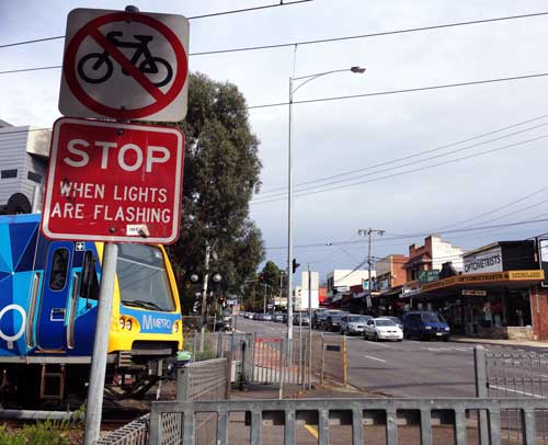
Photograph courtesy of Faith Gritten.
The most viable solution for congestion at these crossings is a grade separation. The 2014–15 State Budget has committed to remove eight level crossings at the following locations:
- North Road, Ormond
- Blackburn Road, Blackburn
- Main Road, St Albans
- Murrumbeena Road, Murrumbeena
- Koornang Road, Carnegie
- Clayton Road, Clayton
- Centre Road, Clayton.
Three of these level crossings link to three of the RACV RedSpots for 2013.
3.6 Using ICT to improve road network use
Road use is increasingly surpassing road capacity as more and more Victorian traffic intersections become congested.
As shown above, although ITS plays a critical role in managing traffic flow, there are limits to what can be realistically achieved where road use consistently exceeds road capacity. In situations of unusual congestion, other transport solutions to address demand-side issues need to be considered.
3.6.1 Better information for road users
The Department of Transport, Planning and Local Infrastructure (DTPLI) and VicRoads do not have comprehensive and reliable traffic datasets for the whole Victorian road network. These agencies provide limited traffic information to road users—such as the severity of traffic delays, reliability of journey times or real-time multimodal journey planners.
As a consequence, Victorians have limited traffic information to allow them to make informed decisions about what route to take, how long the journey will take, or whether they are better off taking other modes such as public transport or cycling.
In other jurisdictions, such as the United Kingdom and France, real-time information is readily available to travellers to assist journey planning. The information is provided either directly through mobile phone applications or through the websites of government transport agencies.
Absence of comprehensive, relevant and reliable data
DTPLI and VicRoads traffic datasets have been collected from different sources—such as detector loops or commercially purchased travel time data. None of these sources covers the whole network or uses the same method to measure congestion.
DTPLI should work with VicRoads to develop new traffic and congestion indicators that better capture information that matters to road users and in terms that road users are able to understand. For example, the severity of traffic delays, the reliability of journey times, or real-time multimodal journey planners.
Reliability of journey time
Transport research literature shows that, for commuters, the consistency of time taken to make a regular journey is as important, if not more important, than the average time it takes to make that journey.
The predictability of journey time can depend on being able to access accurate, up‑to‑date information, in order for a person to decide whether to travel in the first place, when to travel, by what mode and by what route.
To a limited extent, the private sector is already involved in providing some traffic information. However, the experience of other developed countries shows that the provision of relevant traffic information can enhance and promote smoother traffic flow by directly and indirectly influencing motorist and commuter behaviour. It is important for relevant and usable traffic information data to be available.
VicRoads, through its VicTraffic web page, provides some level of traffic condition information in real time. VicRoads also provides traffic information to a number of private organisations, such as media organisations and transport industry groups, who in turn disseminate the information to the Victorian public either through news releases or the internet.
DTPLI, VicRoads and PTV should collaborate to:
- investigate examples of better practice in providing relevant and reliable multimodal travel information services
- decide whether real-time travel information should be provided either directly to the public or through the private sector
- develop a strategy for delivering that information, including the scope for public/private collaboration on deployment.
For example, the United Kingdom's Highway Agency website assists motorists to plan their trips and identify when specific roads are likely to be less congested. It provides up-to-date information about congestion across the network, as well as various modes of transportation, including when and how long each mode would take.
In Lyon, France, the private sector—using government provided data—gives real-time multimodal traffic information including car parking availability.
No Australian jurisdiction provides real-time traffic information at the same level that these international jurisdictions currently offer.
3.6.2 Other ICT traffic management solutions
There are other ICT traffic management solutions being used in a limited way by VicRoads. DTPLI and VicRoads should evaluate the cost and benefit of further deploying these ICT traffic management solutions across the Victorian road network.
Automatic incident detection system
VicRoads is currently working to activate the STREAMS Freeway Management System to automatically detect incidents on freeways.
Using CCTV, STREAMS should be able to automatically detect events such as stationary vehicles, vehicles driving the wrong way, fallen objects or cargo, or the presence of pedestrians on freeways. Once detected, the system will then automatically deploy an appropriate pre-programmed response.
This ICT development has the potential to prevent or minimise the consequences of follow-on accidents and road incidents.
Variable message signs
On limited portions of the road network, variable message signs allow motorists to make informed decisions about route options by giving advice on indicative information on travel times and traffic conditions. Experience in other jurisdictions shows that an early warning provided by electronic signs can influence a motorist's decision about which route to take.
Reversible traffic lanes
A reversible lane allows traffic to flow in either direction, depending on certain conditions—e.g. unusual congestion or incidents. International transport research studies show that reversible lanes improve traffic flow during peak hours by having overhead traffic lights and signs notify drivers which lanes are open or closed.
In Melbourne, reversible lanes are only currently in use along Queens Road adjoining Albert Park, and along Johnston Street from Collingwood to the Yarra River Bridge in Abbotsford. Experience from these installations could be translated to other congested parts of the road network to improve flow during peak periods.
Recommendations
That VicRoads:
- improves performance monitoring of deployed intelligent transport systems and assets by:
- developing reliable and cost efficient methods to monitor performance of intelligent transport systems and assets
- developing a set of performance indicators that includes measures of reliability and effectiveness
- as a priority, makes improvements to the traffic signal review program, including:
- increasing the frequency of reviews
- working with transport agencies and stakeholders when considering which routes to review, such as public transport routes
- undertaking cost-benefit analysis of traffic signal modifications
- to better inform decisions, evaluates the costs and benefits of further deployment of intelligent transport system assets such as
Appendix A.Audit Act 1994 section 16—submissions and comments
Introduction
In accordance with section 16(3) of the Audit Act 1994, a copy of this report was provided to the Department of Transport, Planning and Local Infrastructure, Public Transport Victoria, and VicRoads.
The submissions and comments provided are not subject to audit nor the evidentiary standards required to reach an audit conclusion. Responsibility for the accuracy, fairness and balance of those comments rests solely with the agency head.
Responses were received as follows:
RESPONSE provided by the Secretary, Department of Transport, Planning and Local Infrastructure
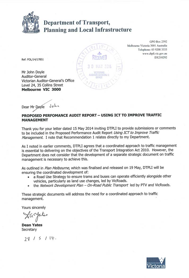
RESPONSE provided by the Chief Executive Officer, Public Transport Victoria
RESPONSE provided by the Chief Executive, VicRoads
